Skip to content

Posts from the ‘Articles’ Category

National Archives UK Photo Finder

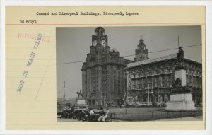
Photo card showing the Cunard Building and the Liver Building, from The National Archives

Cunard and Liverpool Buildings, Liverpool, Lancs., from UK Photo Finder

The National Archives have produced UK Photo Finder, a map-based tool for finding historic photos in your area.

The free tool is one of their ‘Lab’ projects, and so is open for comments and queries, though you may find a few bugs here and there (one user found it doesn’t work on Firefox for the Mac, and I’ve found it can occasionally refresh at annoying moments). Nip on to the site and have a play around.

There are 31 photos of Liverpool City Centre (although there’s a sneaky one of the Sefton Park Peter Pan statue in there); 5 attached to Huyton; and 18 on the Wirral.

The images are also shown attached to their record cards, keeping the photos ‘in context’ as archives, not just as photographs.

The photos at the moment are exclusively from the important Dixon-Scott collection, although I suspect that if this pilot is successful, they will extend it to other collections. I hope they do, as this is a really great site. Dixon-Scott is of great interest to readers of this blog, as he saw and recorded the changing landscape of Britain with the expressed aim of preserving what he saw as the disappearing landscape.

It’s also quiet similar to the independently produced (and ‘crowd-sourced’) Historypin project, which I also recommend you have a look at (and which also has a few bugs to iron out).

Some historical entertainments

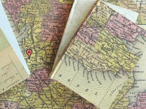
The ghost town of Argleton, as old maps may have seen it

The mysterious town of Argleton, as a paper Google might have seen it, by Nefi via Flickr

I did recently promise some more entertaining blog content after the ‘historic environment’-heavy post this week. So here’s something to stick on your new iPad (or other less fancy PDF readers):

History of World Museum Liverpool

The institution currently known as World Museum Liverpool has a very long history. 150 years to be precise, and it’s celebrating in various ways. Download their free PDF called Liverpool’s Museum: the first 150 years.

I’ve not read the whole thing yet, but it’s already turning into a fascinating story of figures such as Thomas John Moore, William Brown, J.A. Picton and Lord Derby, who have all, in one way or another, left their mark on the city of Liverpool.

Lewis’s Slideshow

When you’re done with that, you should watch the ‘audio slideshow‘ commemorating the even older institution of Lewis’s, featuring voice-overs from former managers and employees, and with a soundtrack of the likes of ‘In My Liverpool Home’, which mentions old Dickie in passing.

There are some great images of the 1950s cafe interior, and the shop floors in days gone by.

Landscape Mystery

Now, you knew Google was getting too powerful, didn’t you? But now it’s creating whole English towns where none should be.

Do you know where Argleton is? Well, according to Google Maps it’s just off the Liverpool-Ormskirk road, near Aughton.

A trap to catch the unwary map-copier? A bad transcription of Aughton? Or a secret base where Google plans to spread it’s evil plan? You decide!

Liverpool Museum gets training grant

In the midst of economic troubles for many externally-funded organisations, National Museums Liverpool has struck lucky in getting £350,000 from the Heritage Lottery Fund.

The money will be used for audience development – reaching out to those who wouldn’t normally see the museum as ‘for them’. Six two-year placements at the new Museum of Liverpool will start from next year. More details available at Art in Liverpool.

Advice for Historic Areas Conservation

A view of Liverpool Museum and Mann Island from the Albert Dock, Liverpool

Liverpool Waterfront, by adebⓞnd, via Flickr

There’s a lot of bits of interest dotted around the place at the moment, so tonight I’m going to concentrate on the serious stuff, with a couple of more fun things later in the week!

Understanding your local history

Local groups are some of the most important people to help protect the historic parts of our towns and cities. Along with planners, developers and local government, they have the greatest influence on what happens (or doesn’t happen) to historic buildings.

English Heritage have recognised this in their latest guidance notes called Understanding Place (see the Related Publications link on the right). The documents focus on Historic Area Assessments, which are one method of ‘characterisation’ which aims to assess the significance of a historic place through objective research using maps and other documents (it’s a bit like what I do for Historic Liverpool!).

If you’re part of a community group, or it’s your job to study local history and archaeology in a planning and development context, download the free PDFs from EH’s website.

On a wider scope, English Heritage are also asking for your opinion on the National Heritage Protection Plan (NHPP). There’s a survey linked to from their NHPP web page.

Merger questions for two of Liverpool’s major agencies

Liverpool Vision (public sector body dealing with regeneration) and the Mersey Partnership (part-public funded, concerned with tourism and investment) may merge as part of efficiency savings by Liverpool Council.

A report is being written by Professor Michael Parkinson of John Moores University, after the council’s new leader Joe Anderson ordered a review. The North West Development Agency (NWDA), as major funders of both bodies, are also in support of the report. Anderson said: “I want to make sure we are efficient and delivering the best possible services and that overlaps and duplication are taken out of the system”.

Do you think a merger will have a positive effect on Liverpool? Or will any cuts risk the city’s continued resurgence?

And finally…

What do you really think of the Mann Island developments? I mean – really? Now’s your chance to let Matt Brook, the man responsible for the “people-orientated approach for design” at Mann Island, know. For more, through-gritted-teeth, details, go to the new Seven Streets website.

They’re article Total Eclipse of the Heart is quite, well, heartfelt too.

New book on Liverpool’s buildings, and how cities make us

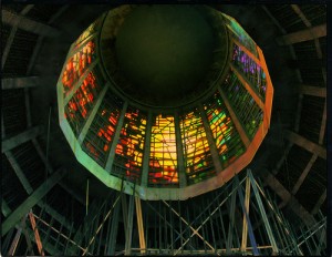
Looking up at the interior of the Roman Catholic Cathedral, Liverpool

Liverpool Metropolitan RC Cathedral, by Jonathan Gill via Flickr

A new book is released this month by Stephen Bayley, and published by RIBA.

Liverpool: Shaping the City is a large and colourful exploration of the city’s built history. It includes development, old and new and brings in photographs from the early 20th Century when some of Merseyside’s most iconic buildings were being constructed.

We learn in the Foreword by RIBA’s president Ruth Reed that Liverpool can lay claim to three world firsts in architecture: the first building to use skyscraper technology (Oriel Chambers in Water Street), the first wet dock (no prizes for guessing) and the first hydraulic cargo-handling system.

Perhaps I’ll come back to a full review of this book once I’ve read it (it only arrived this morning!), but suffice to say it looks to include good coverage of how Liverpool has developed as a city, and how it does and will continue to change as the years progress.

Meanwhile, you can read a column in the Times by Stephen Bayley, How Liverpool returned from the dead which introduces some ideas from the book. His main point is that you can ‘design your way out of a depression’ by building cities which bring joy to people. From a personal point of view, I whole-heartedly agree (though my cynicism would reword it as ‘design yourself towards the end of a depression), which is why I – and others – get so animated when an ugly construction is plonked down in a beloved vista.

My favourite quote from the article, and one which almost single-handedly justifies this blog and my interests in Liverpool’s buildings, is “We make our environments and then our environments make us”. He suggests putting it on a T-shirt, and I just might.

Web Sites for Local History

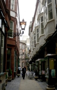
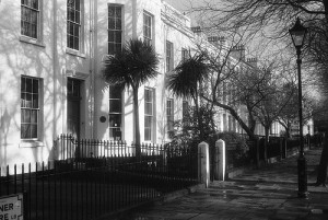
Queen Avenue, off Castle Street, by M D Greaney

Queen Avenue, off Castle Street, by M D Greaney

Over the past few weeks I’ve come across a handful of very interesting looking sites for those of you with a local history interest. The best thing about them is that they’re after your input, so pop along and see what you can contribute!

Building History is a specialised wiki site, much like the (in)famous Wikipedia and the Liverpool Wiki. It encourages users to submit information about any road or building to its database, even the one you live in! Almost 200 roads and nearly 300 buildings have been added, and the site’s only been online since October 2009.

All you need is an email address, and you can get going. The Warwick page is the most complete, so use that as a template. Liverpool is there, waiting for someone to add something, though note that it’s placed in Lancashire!

For those privacy-concerned individuals (like me), it’s good to know they only allow publicly-available data to be added (census data, for example).

Liverpool Signs, Mosaics, Words and Graffiti is a set of photos on Flickr which collects together a huge number of images of… well, signs, mosaics, words and graffiti.

The most obviously interesting ones to readers of this blog are the ancient signs painted on the sides of warehouses and shops, or the tiled signs such as this Liverpool Co-operative sign in Bootle. But the collection also includes a huge number of other examples, from the formal to the most informal.

Of especial interest to me, as a ‘hidden landscape’ geek, is the boundary marker from Smithdown Road. I’m not sure whether this is a township boundary post or one for the London and North Western Railway (that’s the stamp on the marker), but Smithdown Road crosses the old boundary between the Toxteth and Wavertree townships.

Two other Flickr Groups you might be interested in are the Old Liverpool and Secret Life of Smithdown Road groups.

Finally, we have the Open Plaques project. This, in its own words, is “a service that aims to find and provide data about all the commemorative ‘plaques’ (often blue and round) that can be found across the UK and worldwide”.

You can browse their database via peoples’ names, places, or organisation, and the site wants all the plaques photographed, tagged with their geographical location, and have their colour identified. There’s a neat little graph on the home page letting you know how they’re getting on.

The data comes from a variety of sources (including English Heritage’s blue plaques site and Freedom of Information requests) which have been cleaned up for presentation on the site.

You can help them by getting in touch, or taking a photo of one and uploading it to Flickr. If you tag the photo correctly (as explained on the site) it will appear next to the relevant entry. Brilliant! All the data is free for you to reuse, and the maps are created using OpenStreetMap. You can follow the project via Twitter: @openplaques, or on their .

There are nine plaques for the city of Liverpool.

Maps for Local History Research (part 1: Modern Maps)

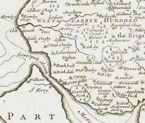
Extract from a map of Lancashire, by Robert Morden, 1695

Liverpool, from Lancashire, by Robert Morden, 1695

This is the first in a series of posts which will hopefully help you research the local history of your area, whether it’s Liverpool or elsewhere. It’s about maps, as my own main site, Historic Liverpool, is based on maps. Part 1 will focus on late 19th and early 20th Century maps.

Beginning Map Research

Maps are an amazing way to research local history. For one, you can start with a recent map, and then by looking at increasingly older editions you can see in reverse the changes which have happened over time. You start with something very familiar, and gradually work your way back. Sometimes, an unbelievable amount has changed in very little time.

But whether you are researching Liverpool, or another city or any rural area of Britain, you’ll need to know what maps have been made of your location, and when they were made. Luckily, in this day and age it’s not hard to find them.

For every local historian, the first port of call must be the Ordnance Survey maps. You can pick up the current version for around £8, or a recent second hand copy off eBay for a fiver. Get a 1:25,000 Explorer map – these show individual buildings but cover enough area (unless you’re really unlucky!) for your needs.

That’s the easy part!

Now you have your anchor, your reference point for all the other maps you’ll be looking at. This serves as the base for your next step, which is known by the professionals as ‘map regression‘. This just means that you collect as many maps as possible, and work your way back through them and noting the changes. I’ll work through an example of this in a future post.

Getting a recent map of your area should be easy enough, but slightly older ones are going to be second hand, so you need to be aware of where to get them.

Second-hand and online maps

eBay

Your first choice for buying paper maps has to be eBay. I’ve bought almost all of my OS maps from this site, each for about the price of a pint of beer. eBay seems to be strongest with the years between 1930 and 2000, particularly 1950 – 1980. OS maps from across this period repeatedly appear for a couple of pounds. Keep an eye on this site so you’re ready when the right map appears, and also you’d do well to keep an eye on what you’ve already bought – more than once I’ve nearly ended up with two maps from the same year!

The list I have for Liverpool includes: 1947, 1952 (last revision 1947-9); 1961 (last revision 1958), 1964, 1978 and 2000. (For an excellent overview and samples of all the OS map series, see http://www.charlesclosesociety.org/osseries).

Older OS maps are a bit harder to find (see below), although occasionally a great find pops up on eBay. Luckily, there are ways you can get a look at OS maps without leaving the comfort of your own home. There are a couple of web sites which let you view old OS maps, and some of these are very nifty mapping sites in their own right.

Old OS Maps

Old OS Maps is a simple name belying an amazing little tool. Unfortunately there’s a big black hole where Liverpool should be. I’d scan in one of my own maps to donate it if only I had a big enough scanner! However, the site’s well worth a look, as it overlays a small modern Google map extract over the centre of the screen, overlaying an OS map from around 1925 to 1945 (depending on location). Have a look if your area lies outside Merseyside.

Leverpoole.co.uk

Leverpoole.co.uk used to be one of the best sites for Liverpool maps. However, most of the maps have been removed now due to ‘unauthorised use‘. This, like the much-missed Toxteth.net, used to be a fantastic resource. It’s a great shame that the owner, Tony Swarbrick, felt this action necessary, and a shame that his stuff was being used without his consent.

However, there is still the 1930s Philips Street Map of Liverpool on there. This is divided into squares, based on the original map gridlines, which are scanned in at a high resolution. There’s also a text index below the map if you know the rough area you’re after but can’t spot it on the map. And then you can click to enlarge the image, which is a great bonus!

Sites of interest on this map are the Overhead railway down the Strand, and the Chester Basin still open in front of the Dock Board Office.

As an aside, Leverpoole.co.uk also has a huge number of photos of Liverpool, which are great for researching listed or historic buildings.

Commercial map sellers

Getting maps off eBay, and viewing maps online are the cheapest ways to get the most common editions, but the following sites will sell you brand new reproductions of old maps. This includes difficult-to-find early editions.

Alan Godfrey Maps

This site publishes a huge list of maps of Liverpool and elsewhere. They’re paperback maps about A3 size, and extremely detailed (though that means they cover a small area). The strange thing about this site is the lack of illustration, and that once you click on links the text turns yellow, making them very difficult to see! However, the maps are an unparalleled resource, and are also sold all the time on eBay.

Cassini

Cassini are a large commercial map company, slightly reminiscent of the National Archives web site, and sells highly polished map products of all types. You can get downloadable or printed maps, and specify the area and period you want. There’s also a boxed set of maps of Liverpool, which comes in useful for the wide-ranging form of map exploring!

David Archer Maps

In many ways David Archer’s is a strange site. Again, a site with little in the way of pictures, and a shop which appears to take orders exclusively over the phone. Still, it’s these quirks for which I have a certain admiration. Take a look at the informal blog “A nice cup of tea and a chat about maps”: it’s quite a rambling but entertaining diversion into other map sites, Christmas cards and exhibitions. It also reveals that David’s a fan of free and open source software, which always gets the thumbs up from me!

There’s a massive list of all the maps they stock, but if you don’t know what you want, or can’t find it, then they encourage you to contact them.

Last Words

This has been a fairly lengthy overview of map sources. There are many more online, but these are the few I keep going back to. In the next part of the series, I’ll have a look at older maps, which are often a lot harder to find.

Of course, if you know of better places to get hold of old maps, share it in the comments!

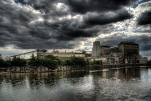
How Merseyside’s Historic Landscape Helps During the Snow

Northwich Salt Factories (part 1), by DaveAdams via Flickr

Northwich Salt Factories (part 1), by DaveAdams via Flickr

The local landscape is playing a major part in snowy events on Merseyside this winter. Salt companies in Cheshire are finding a boom in trade as councils run low on supplies of grit for roads. British Salt Ltd in Middlewich is apprarently running 24/7 and still having trouble keeping up with demand.

Ineos in Runcorn is also helping out, with 12,000 tonnes of salt having already left their depot.

Salt has been an incredibly important industry in Cheshire since at least Roman times, and almost certainly prior to that. Middlewich, Nantwich, Northwich and Winsford are all historic salt mining locations. Middlewich was even called Salinae by the Romans, showing how important the location was for salt (salt was, in turn, of extreme importance during the Roman period. Salt could be used as currency, leading to the modern English word ‘salary’).

PS: Love that amazing HDR photo above, by DaveAdams!

Liverpool 100 years ago

The Echo are starting a new history series, looking at Liverpool 100 years ago. The first, introductory article talks about monarchs, strikes and riots, the Titanic and the Suffragettes.

The main photo in the article shows the Mersey in 1907. Of the major Pier Head/Strand buildings only the Port of Liverpool Building has been built, and it stands head and shoulders above everything else in the viscinity. What a change! This building now feels right in the centre of the commercial district, but at the beginning of the 20th Century this merely meant the docks and the Overhead Railway. The other two Graces, and Tower Building etc, are yet to be contructed, and yet to take their place as the centrepiece in Liverpool’s skyline.

Liscard Hall not to be rebuilt

Finally, news reaches us that Liscard Hall, which burned down in 2008, will not be rebuilt. The Hall was built by Sir John Tobin, one time mayor of Liverpool and successful trader. The grounds of what was once known as Moor Heys House became Central Park in 1891.

Plans now include landscaping of the gardens, and linking them more successfully with the nearby rose garden.

See the Geograph page for National Grid Reference SJ3191 site for a photo of the Hall and Central Park.

Liverpool’s Heritage Counts

The Embassie, by Fabio Mascarenhas via Flickr (CC)

The Embassie, by Fabio Mascarenhas via Flickr (CC)

Just a quickie today: English Heritage recently released their eighth annual Heritage Counts report. On their website the country is divided into ten regions, of which the North West Region (Merseyside, Cheshire, Great Manchester, Lancashire, Cumbria) is one. The page on this region includes a summary report (PDF) as well as a number of other documents in PDF and XLS format.

The summary report has details of the number of historic sites across the North West (listed buildings, world heritage sites etc), and details the managing of the historic environment in relation to how it was done in 2002/3. Managing Positively talks of an increase in scheduled monument consent and conservation area consent, showing that the North West remains a changing landscape, despite its thousands of historic ‘assets’.

Sections on Participation and Education show that more families and schools are visiting National Trust properties, and Heritage Protection Reform promises that a new integrated approach to conservation will be possible when such reform has been completed.

Have a look at the report yourself, glance through the tables and let me know what you think! Of course, my favourite part is that World Museum Liverpool is on the regional page and in the PDF report – clearly an outstanding example of the North West’s heritage!

Liverpool History Society Questions online

Some very interesting bits from the Net recently:

Liverpool History Society Questions is a blog I always watch – readers ask questions and (more often than not) Rob Ainsworth of Liverpool History Society comes up with an answer. Topics range from buildings to family history to maps, and two recent topics will be of interest to readers of this blog. From October 15th there is a great and detailed description of court houses in Liverpool. These cramped, airless and dim dwellings were thrown up around Liverpool in the 19th Century, and hundreds of families lived in them. I know that a number of my own ancestors lived in such conditions in Toxteth and around the Cathedral area (as it is now). The famous Dr. Duncan played a key role in their investigation, and there are only a couple left in the city (listed in September this year).

On October 19th a reader asks about the 1725 Chadwick Map, which should be familiar to anyone having researched Liverpool’s urban history for any length of time. The authenticity of a copy for sale in the US is in question, and Rob Ainsworth does a great job in describing the map’s history. Chadwick’s map is annotated with road names and landmarks in the margins, and can be seen in many Liverpool history publications, such as Aughton, and Liverpool 800. A decent reproduction can be found on the Mersey Gateway (though the labels are barely readable.) A paper copy can be bought from Scouse Press.

In a few other bits of news, the forever-delayed tram system may never see the light of day: http://news.bbc.co.uk/1/hi/england/merseyside/8314734.stm

In a follow-up to my recent post on ShipAIS, you can keep track of the Queen Mary 2 while it stays in Liverpool: http://www.shipais.com//showship.php?mmsi=235762000

Uses for Liverpool’s Listed Buildings

The Observer reports on a survey by McBains Cooper which suggests that giving Grand Designs-like makeovers to Britain’s vacant listed buildings could help with the shortfall of up 1 million homes.

The suggestion is that the hundreds of listed buildings which are currently out of use could be converted to flats and houses. However, the main objection is the red tape and hassle that owners expect to have to go through to get plans accepted.

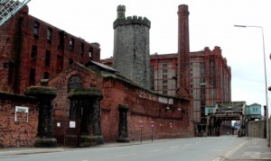
Stanley Dock by Paul Holloway, via Flickr

Stanley Dock by Paul Holloway, via Flickr

Having seen, and mapped, the listed buildings most at risk in Liverpool, according to English Heritage, I know that a great many of them lay dormant, without use and without any plans for the future. My favourite is the tobacco warehouse at Stanley Dock. This is a colossal building, and identical to all intents and purposes to the warehouses at the King’s Dock which are now plush and expensive footballers’ homes, and which ensure the preservation of these globally important structures. There seems no reason why the Stanley Dock warehouses couldn’t be put to similar use. New flats are also found all along Waterloo Road, occupying former derelict buildings. Perhaps it is only a matter of time before Stanley Dock is converted. Maybe the owner has been waiting for the best time. But these kinds of projects need to be started sooner rather than later. How many flats could you fit in that warehouse, plus shops, parking and maybe offices on the ground floor? Granted, at the moment these buildings are a tad out of the way of the city centre, but the location must be attractive to many who would save on transport costs to the offices and shops in town.

There also has to be the one project which starts the regeneration of the entire area all the way up Waterloo Road to Nelson and Huskisson Docks. The main thing to remember, however, is that the housing shortfall is not with the wealthy King’s Dock flat owner types. It’s with the thousands of families who can’t afford a house, so it would be no good to create another ‘exclusive’ gated community. Could a Stanley Dock scheme both ensure the preservation of the warehouse structure and provide a more accessible housing scheme than Kings or East Waterloo Docks?

Of course, there are other vacant listed buildings in Liverpool, crying out for regeneration. What buildings in your area could benefit from such a scheme?