Skip to content

Posts from the ‘Articles’ Category

Heritage at Risk in Historic Liverpool

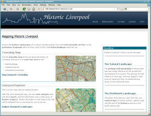
Home page screenshot as built in Drupal

Home page screenshot as built in Drupal

Yes, that’s a headline and almost a pun at the same time, for of course the ‘Historic Liverpool’ in the title is your favourite map-based exploration of Merseyside’s history, Historic Liverpool. I have spent rather a lot of hours over the last week moving the entire site from lovingly hand-crafted HTML to Drupal, an open source (Free) content management system (CMS). This wonderful technology means I can spend less time on moving bits of the site round, while having to copy all changes from one page to another, and simply let Drupal do all the work. For anyone who’s used a blog this will be familiar territory. You simply type what you want into the CMS, and the pre-set design will take care of all the menus, sidebars etc. on all the pages. On a technical note, unfortunately MapServer, which I use to create the maps, doesn’t play well  with Drupal (unless I upgrade my hosting package), so the mapping pages are done the old fashioned way – by hand. There are a few more stylistic tweaks to make (the article text is a bit small at the moment) but the site should be easier to maintain from now on.

Which brings me to my main point, which is that I now have more time to add stuff to the maps, and I’ve started with the Buildings at Risk in Liverpool, which can now be found on the Liverpool Explorer map (have a play around with the other layers while you’re over there). Clicking on one of the diamonds when takes you to a summary of the state of these buildings, from where you can click through to the main English Heritage website for more details and a photo. When I get a chance to, I hope to be adding my own photos to the site, as the ones on english-heritage.org.uk are a bit small.

I hope you enjoy this first of many new layers (hoping to add other ‘At Risk’ sites soon), so please do send feedback!

See also:

Save Britain’s Heritage: I’ve read this organisation’s book Triumph, Disaster and Decay: the Save survey of Liverpool’s Heritage (2009). It was mostly decay, with the odd disaster here and there, and quite sobering story of the buildings lost on Merseyside since the Blitz. In the end it was a big inspiration to include the Buildings at Risk on this site, so try to find a copy if you can.

Conservation Areas Resources

I’ve recently mentioned English Heritage’s ‘Heritage At Risk’ campaign and project, so I thought I’d point any interested parties in the direction of some good resources to look at on the subject.

If you know of any other places to find details of CAs at risk, let me know in the comments!

Liverpool photographs on ViewFinder

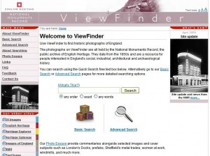
The Homepage of the ViewFinder website from the NMR

The Homepage of the ViewFinder website from the NMR

I’ve known about this site for a while. OK, I admit it, I worked on the project myself for five months in 2007. But the ViewFinder website from the National Monuments Record is an amazing resource, where you can access around 80,000 images from the NMR’s collection for free. Try out the results for an Advanced Search for Liverpool. My favourites are the ‘merchant palaces’ of West Derby, mainly because that’s where I grew up!

Let me know what you think of the site!

www.viewfinder.english-heritage.org.uk

Access to Historic Liverpool data

In the spirit of free exchange of data, I’ve been looking into methods of sharing the data which I produce as part of the Historic Liverpool website. Although still a relatively low number, I will be producing ESRI shapefiles which are used to power the maps. As the About this website page explains, the layers of Listed Buildings, Parks and Gardens, Scheduled Monuments and World Heritage Sites are from the NMR’s Data Download service, where you can get hold of the national data after signing up for an account. I can’t redistribute the NMR’s data, but I intend to post direct links to my own created layers in due course. There are many ways of doing this, but an important question is one of data formats. Which data formats can I be certain that people can use, for free? Well, I know shapefiles can be used in such free (as in open source) software as QGIS, but I’d like to be able to give out data which is viewable in Google Earth, as this is a popular, free (as in no cost) piece of software which provides background mapping, which are near-impossible to come across in the UK for sensible amounts of money. It would also be great to be able to integrate my data with fun stuff such as topography and 3D historic buildings, of which a handful from Liverpool are available on Google Earth.

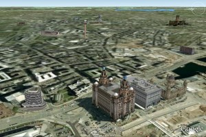
Google Earth view of Liverpool Pier Head

Google Earth view of Liverpool Pier Head

At the moment I’m therefore looking for ways to convert shapefiles to KML files (which can also be viewed in Google Maps without the need to download extra software). There are several programs simply called ‘SHP2KML’ which claim to do the job. If anyone’s done this before, or knows a better way to do this, I’d be grateful to hear it. Otherwise I’ll be studying the manuals for the ever-useful FWTools command-line programs.

Finally, on the topic of online resources, Wolfram Alpha is a new “computational knowledge engine”. It works like a search engine, but instead of bringing back a series of web pages which probably contain your results, it tries to reply with the results themselves. This is best seen in demonstration, so try going to the site and typing “population of liverpool” and see what you get!

Historic Liverpool on the Web

As things seem to be quiet on the ‘historic Liverpool’ front (that’s historic with a small ‘h’ – not my website!) I think it’s a good time to put down a few quick notes about where Historic Liverpool (the website!) and my interest in history on the web should be leading me in the next few weeks and months.

For those of you eager to see what additions will be made to the main site, I can tell you that I’m currently researching West Derby township. This includes the former villages of Tue Brook, West Derby, Knotty Ash and Broad Green, and will hopefully be online soon. Anyway, until then…

Every month new historical and archaeological resources go online (for example the Liverpool Wiki), and the ones that have been online for a while are constantly adding to their databases (see the Archaeology Data Service). Though the Council for British Archaeology’s website (recently relaunched) was a pioneer in making use of the web for archaeology, the historical and archaeological disciplines are only gradually making full use of the web, in particular “Web 2.0“, the interactive web. This new, user-generated form of the Internet is a big opportunity for history and archaeology, building on the participation seen in many amateur excavations in Britain for decades, and the discussion forums taking in Liverpool history amongst other city issues all over the Net.

It’s part of my job to know about what makes an attractive, usable, interesting heritage website, and I’d like to pass on what knowledge I can to help promote new archaeological and historical Web 2.0 sites. My own site, Historic Liverpool, shows my own modest efforts (more archaeology than Web 2.0!) but so much more sophisitcation is possible in this developing era that I really want to do what I can to help. With this in mind, I will shortly be launching a new website (to be named – watch this space!) dealing with [edit:] expanding this blog to include the wider developments in heritage on the web. There’ll also be a blog there, where I will put my thoughts down on the subject, along with longer articles on avoiding some of the pitfalls of building a complex or data-rich website aimed at the general public and interested amateur. After all, this is the advantage of the Internet, and the sharing of data and knowledge – anyone can become involved! Edit: for now I have little time to dedicate to a new website, so I’ll be mentioning interesting web initiatives on this blog until someone invents the 34 hour day and I have time to write two blogs!

Finally, while researching West Derby I read the relevant chapter in J.A. Picton’s Memorials of Liverpool, vol II, Topographical (1875). In it he details all the roads from Low Hill eastwards, and takes in Kensington, and Newsham Park. He rues the state of Wavertree Road:

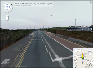
Picton Road as seen by the Google StreetView car

Picton Road as seen by the Google StreetView car

“at present a somewhat unsightly entrance into Liverpool … flanked with shops and dwellings of an inferior class. Down to 1830 this road was a beautiful avenue lined with tall trees on each side, whose umbrageous foliage meeting overhead, imparted a grand and solemn character to the vista. The construction of the railway crossing the road … and the subsequent construction of the bridge … made the first inroad”

This fairly judgementmental description of the area is typical of this wonderful book, but the modern mapreader must note that whereas in 1875 Wavertree Road stretched all the way to Wavertree (of course), these days the length from Picton’s bedevilled railway bridge to the clock tower is of course… Picton Road.

Truimph, Disaster and Decay the save survey of Liverpool’s Heritage

From www.savebritainsheritage.org:
“As Liverpool emerges from its year in the limelight as European Capital of Culture, a new exhibition, mounted by SAVE Britain’s Heritage, takes a sobering look at the state of the city’s architectural heritage.” This exhibition is being held at the RIBA gallery in Liverpool from 16 February until 6 March 2009. Check out the SBH’s news pages for more details.
They also have a new publication, Triumph, Disaster and Decay, a survey of Liverpool’s heritage. It “shines a light on fine buildings suffering from long-term neglect”. It also covers new development in the World Heritage Site and clearance in the suburbs, and includes a gazeteer of buildings at risk in Liverpool. The book costs £12.50, or £10 for Friends of Save.

Also, the Echo Arena is one of four Liverpool buildings in the running for a top national architecture award, the Civic Trust Award.

Liverpool’s Trams Old and New

Everton FC’s controversial plans to move to a new stadium in Kirkby are strengthening the case for “line one”, the non-capitalised tram scheme from Liverpool city centre to the outskirts. This follows claims in mid-April that Transport Secretary Ruth Kelly was ready to approve the £328m transport link.

Of course, trams are nothing new in Liverpool, which can trace their history back to 1869, and the 16 horse-drawn trams which were brought into use then. The service stopped on August 14th, 1957, when Liverpool discarded the trams in favour of buses. The network left behind many remnants embedded in the towns fabric, from the central reservations of the suburbs to the cobbles under the tarmac of the city centre streets.

Another thing which stands in favour of recreating the tram system shapes the very city we see today. As I mentioned, many of the wide boulevards which snake through the suburbs, such as Edge Lane, Muirhead Avenue and Queen’s Drive. Hidden under the grass the tracks no doubt still lie there. Of course it wouldn’t make sense to try to re-use the rusty metal, but the long curves of the roads themselves lend well to the three or four carriages which modern tramways like those in Sheffield and Manchester. In fact, if you look at a map of Liverpool, you can see how the tramways of the last century, and the routes people took into work – the financiers, traders and sailors – had an influence on the growth and development – the very shape – of the city in its boom era.

Some news about the main website: I’m releasing all the information on the website under a Creative Commons License, specifically the Attribution Non-commercial Share Alike (by-nc-sa), which means you are allowed to create works based on my work, as long as it’s not for commercial reasons, and you are willing to share what you’ve created too. It’s all in the spirit of sharing! For more details on what the license means, read the easy and short version, or the longer, legalese-heavy code.

Liverpool’s Docks and Railways

Although Liverpool is famous for its docks, and (criminally, to a lesser extent) the railways, taking a wider view reveals the interlinking threads which join the two transport systems, and gives a few insights into the buildings nearby. The recently revealed Manchester Dock (once under the car park of the old Museum of Liverpool Life) was one of the earliest docks on the river front, having originally been no more than a tidal basin connected to the river Mersey. The dock was used to hold the barges of the Shropshire Union Canal Company, and later the Great Western Railway, in order to transport goods between Liverpool and the rail terminal at Morpeth Dock in Birkenhead. In this way Manchester Dock played a role as a go-between, from the national rail network (connecting Liverpool – via Lime Street – to the industrial centres of Britain) and further ports of call on the other side of the river. The warehouses standing next to Canning graving docks – until recently the home of the Liverpool Museum field Archaeology Unit – still bear the name Great Western Railway on the canopies at the front.

Time Team are showing a’ Special’ on the Manchester Dock on the 21st April. Although the adverts would have you believe Phil uncovered this crucial piece of Liverpool’s (and indeed the world’s) maritime history, excavations have been taking place for a while. Read Liverpool Museum’s blog to stay up to date. Also check out their Flikr site.

Michael Palin is coming to Liverpool to open an exhibition at the Walker Art Gallery on art and railways (Art In the Age of Steam, Walker Gallery, April 18 – August 10).

Developments along the Mersey, move for the Phil, and origins of Scouse

Having recently taken ownership of the Beatles Story in the Albert Dock, Merseytravel have added a new Fab Four attraction to their collection: a set of bushes in the shape of the band.

A new Mersey Observatory will replace the radar tower at the mouth of the Mersey, near Crosby. The winning design, by Duggan Morris Architects, was chosen from a shortlist of five from 92 entrants, and will include a viewing tower, cafe, and exhibition centre.

Vasily Petrenko, the conductor of the Liverpool Philharmonic Orchestra, has backed plans to move to a new, purpose-built home on the waterfront. The long term ‘dream’ would be “amazing… It could be part of a real cultural hub for the city.” The move would solve increasing problems over lack of space.

Liverpool University has invited researchers from Liverpool, Edinburgh and Lancaster to explore the origins of Liverpool’s unique accent. Dr Andrew Harmer, from the School of English, said “The Merseyside accent was first identified in the late 19th Century, and it has been argued that it came about from a blending of Lancashire and Irish speech varieties. If this theory is correct, we might expect Scouse to have been at its most distinctive at the time when having an Irish background was at its height among the people of Merseyside. This has not been the case, however: instead of becoming less distinctive as our kinship with Ireland decreased, the accent has become stronger.” For more information about the event go to AlphaGallileo.org.

Update on the Meols Viking Boat Burial

After much speculation about the possibility of a Viking boat being discovered under the car park of the Railway Inn, Meols, staff at World Museum Liverpool’s Field Archaeology Unit have written an article outlining the ways in which archaeologists must go about deciding what to do with the buried vessel. As well as damping down runaway speculation as to the age of the boat, the piece gives an excellent insight into how field archaeology works in general when considering the need to excavate buried remains.

In essence the article concludes that the boat is not under threat, would cost millions to raise, and would probably cause more harm than good were it to be exposed to the elements. Furthermore, there is no conclusive evidence as to the date of the boat, with some evidence actually refuting claims that it originates in the mid to late part of the first millennium AD.