Skip to content

Posts tagged ‘landscape’

Whatever the Risks, it’s people that keep history alive

This week we get an updated list of the heritage at risk on Merseyside, see a unique perspective on how Liverpool has changed over the last few decades, plus some personal points of view on Liverpool and its past.

Read more

How Merseyside’s Historic Landscape Helps During the Snow

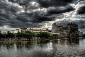
Northwich Salt Factories (part 1), by DaveAdams via Flickr

Northwich Salt Factories (part 1), by DaveAdams via Flickr

The local landscape is playing a major part in snowy events on Merseyside this winter. Salt companies in Cheshire are finding a boom in trade as councils run low on supplies of grit for roads. British Salt Ltd in Middlewich is apprarently running 24/7 and still having trouble keeping up with demand.

Ineos in Runcorn is also helping out, with 12,000 tonnes of salt having already left their depot.

Salt has been an incredibly important industry in Cheshire since at least Roman times, and almost certainly prior to that. Middlewich, Nantwich, Northwich and Winsford are all historic salt mining locations. Middlewich was even called Salinae by the Romans, showing how important the location was for salt (salt was, in turn, of extreme importance during the Roman period. Salt could be used as currency, leading to the modern English word ‘salary’).

PS: Love that amazing HDR photo above, by DaveAdams!

Liverpool 100 years ago

The Echo are starting a new history series, looking at Liverpool 100 years ago. The first, introductory article talks about monarchs, strikes and riots, the Titanic and the Suffragettes.

The main photo in the article shows the Mersey in 1907. Of the major Pier Head/Strand buildings only the Port of Liverpool Building has been built, and it stands head and shoulders above everything else in the viscinity. What a change! This building now feels right in the centre of the commercial district, but at the beginning of the 20th Century this merely meant the docks and the Overhead Railway. The other two Graces, and Tower Building etc, are yet to be contructed, and yet to take their place as the centrepiece in Liverpool’s skyline.

Liscard Hall not to be rebuilt

Finally, news reaches us that Liscard Hall, which burned down in 2008, will not be rebuilt. The Hall was built by Sir John Tobin, one time mayor of Liverpool and successful trader. The grounds of what was once known as Moor Heys House became Central Park in 1891.

Plans now include landscaping of the gardens, and linking them more successfully with the nearby rose garden.

See the Geograph page for National Grid Reference SJ3191 site for a photo of the Hall and Central Park.

Exclusivity: which parts of the city are Yours?

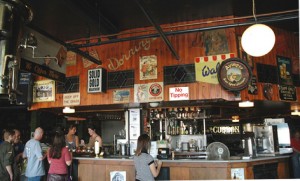
Quiggins Brooke Cafe, by Indigo Goat via Flickr

Quiggins Brooke Cafe, by Indigo Goat via Flickr

Nina Simon, a museum blogger I greatly admire and enjoy reading, recently posted on the topic of ‘exclusive’ places, and the odd way in which people find them more welcoming than more public spaces. She was referring to museums, which can be both public spaces and yet sometimes seem exclusive (to ‘museum-y people’), but everywhere in the landscape can have a sense of exclusivity, to a greater or lesser extent. There’ll be parts of Liverpool you love going to, and which you like because you know ‘your’ people will be there: those with similar interests, from similar backgrounds, of similar age or profession, even people dressed similarly. There’ll be other places which you’d never set foot in: either you simply never go to that part of town, or you avoid drinking in that pub, going into those shops/restaurants. These places make you feel awkward, out of place, nervous, or it may be that they just don’t ‘do’ what you like. Then there are places which change from one type to another over your lifetime: perhaps you grow into them (that pub again) or out of them (playground, playing fields, the street where you grew up).

You may go with friends, or alone, but they are all places which reinforce your feeling of who you are, and who you aren’t. You can share these special places with the right friend; you get that glow from sharing an exclusive place and introducing someone new to something cool.

When I was but a young geek, my friends and I would go to Palace on Slater Street, for all our collectible card game needs! The place was full of other weird and wonderful shops: antiques, piercings, records, books, junk… Quiggins, in its School Lane incarnation, was similar: I loved the cafe on the top floor, and exploring the darkest, strangest recesses of the other shops. Both those places I knew my parents, and my more ‘mainstream’ classmates, would never go. They were my places, and my friends’ places.

Then there is the garden behind Blue Coat Chambers. I was first taken there by a Geography teacher while on a field trip (with 29 other lads, I’ll have you know). It was a little-known backstreet oasis, with a couple of benches, plants and trees. Neglected, maybe, but not overgrown, it seemed like a bit of a secret getaway. This year I went back, possibly for the first time in (yikes) ten years, with my fiancée. It’s had a complete makeover, along with the Chambers themselves, but still maintained an air of quiet solitude, somewhere to escape the massive and modern Liverpool One just over the wall. I felt that sense of showing someone that place for the first time, a place which had been shared with me and a handful of (slightly rowdy) others years before.

There are countless other places which are ‘mine’: parks at Croxteth, Springfield, Sefton, Calderstones (and the corners within them), where I spent parts of my childhood, and which I still visit. If I choose to share these places, at the same time I want to keep them secret, and not to share them with too many people lest they lose that exclusiveness, that specialness.

Which are your ‘exclusive places‘? Are they, like in Nina’s examples, museums? Exhibits? A corner of a gallery? Or one of Liverpool’s parks, or independent shops? Are they big places, or small? Do you share them? Where do you feel you are most you, and how does the location of that place in the landscape affect this? Is it near home? Far from home? In a side street? Right in the limelight with the other trendy people?

Will you share it with the readers of some archaeology blog? 😉

Secret Life of Smithdown Road

National Museums Liverpool are putting on an exhibition at the Oomoo cafe on Smithdown Road, showcasing the way in which the road has changed over the years, reports Art in Liverpool. The exhibition, which runs throughout September, will consist of photographs and stories – the memories of old and young who live and have lived in the area – to build a picture of Smithdown Road over time.

This is precisely the thing I’m trying to do with Historic Liverpool, and it just goes to show that there is an audience out there for this kind of history, this landscape archaeology of a single road! It’s incredibly important when writing about history in such a public arena that you connect with what the audience wants, and not what you want to tell them (unless you’re confident you have a new and interesting angle, of course!). That this exhibition actively involves the local residents is excellent; they are the main audience after all. It’s a shame I don’t think I’ll be able to make it, but hopefully I can learn something from this. I know my own site is quite one-sided at the moment (I’m trying the interesting angle, which hopefully isn’t covered by other similar sites), so in future I will try to add stuff more directly related to the people of Liverpool. After all, the aim of the site is to give you insight into the history of your area, help you explore and encourage you to get out there and see the place in a new light.

I’m still finalising the comments arrangements, but soon you’ll be able to hold forth on pretty much any page, so please do!

Historical notes: Smithdown, once known as Esmedune, was a manor mentioned in the Domesday Book, and was part of the royal forest of Toxteth, used for hunting.

Woodlands Remembered and Created

There is a very strong woodland feel to events in Liverpool this weekend.

Mab Lane in West Derby is being transformed by the planting of tens of thousands of new trees on a brownfield site, in order to create “the world’s most colourful woodland“. Work is expected to start in Spring next year, and will cost £700,000.

Also this weekend, Liverpool’s Pool Project are celebrating that which first brought royal attention to the area, and which is largely forgotten today: the royal hunting forest of Toxteth. The idea is to recreate one of King John’s hunts through 21st Century Toxteth, and at the same time gather information about the archaeology, biology and botany of the area bounded by modern Upper Parliament Street, Smithdown Road, Ullet Road and Sefton Street.

Toxteth Park was part of a large area of land on the north side of the Mersey which was popular with medieval royalty for hunting and riding. For hundreds of years it was ’emparked’, in practice meaning nothing could be built on it. Only when this status was removed did large scale building begin in the area. In its early days it was the preferred suburb for rich Liverpool merchants to escape the hustle and bustle of the city centre. In later years these richer inhabtants of the city moved to other areas such as Rodney Street, north Liverpool/Kirkdale and West Derby. Toxteth became covered in vast swathes of Victorian terraces, built to house the ever-expanding working classes who kept the factories and docks going.

For more information, see the Toxteth pages of the Historic Liverpool website.

Formby dunes under threat

The Telegraph is reporting that the National Trust has identified the Formby dune landscape as one of ten threatened coastal features. Each piece of the coast so named will be significantly altered by the encroaching sea in the coming years, with sea levels expected to rise by up to 1.5 metres by 2100. The National Trust has given up hope of trying to protect them, and will let the sea and weather take its natural course over the coming decades.

The Formby sand dunes are part of a large scale landscape of Shirdley Sand which has been laid down by the wind since the last Ice Age. The coastal dunes spread from north Liverpool to Southport and beyond, and are only the most visible sandy features in a series which stretches inland in Sefton and Crosby, with some now-hidden dunes reaching up to 125m in height. The features are also havens for wildlife.

Liverpool’s Trams Old and New

Everton FC’s controversial plans to move to a new stadium in Kirkby are strengthening the case for “line one”, the non-capitalised tram scheme from Liverpool city centre to the outskirts. This follows claims in mid-April that Transport Secretary Ruth Kelly was ready to approve the £328m transport link.

Of course, trams are nothing new in Liverpool, which can trace their history back to 1869, and the 16 horse-drawn trams which were brought into use then. The service stopped on August 14th, 1957, when Liverpool discarded the trams in favour of buses. The network left behind many remnants embedded in the towns fabric, from the central reservations of the suburbs to the cobbles under the tarmac of the city centre streets.

Another thing which stands in favour of recreating the tram system shapes the very city we see today. As I mentioned, many of the wide boulevards which snake through the suburbs, such as Edge Lane, Muirhead Avenue and Queen’s Drive. Hidden under the grass the tracks no doubt still lie there. Of course it wouldn’t make sense to try to re-use the rusty metal, but the long curves of the roads themselves lend well to the three or four carriages which modern tramways like those in Sheffield and Manchester. In fact, if you look at a map of Liverpool, you can see how the tramways of the last century, and the routes people took into work – the financiers, traders and sailors – had an influence on the growth and development – the very shape – of the city in its boom era.

Some news about the main website: I’m releasing all the information on the website under a Creative Commons License, specifically the Attribution Non-commercial Share Alike (by-nc-sa), which means you are allowed to create works based on my work, as long as it’s not for commercial reasons, and you are willing to share what you’ve created too. It’s all in the spirit of sharing! For more details on what the license means, read the easy and short version, or the longer, legalese-heavy code.

What did King John do for Liverpool? New Mersey crossing and the Dockers’ Umbrella under fire

The Liverpool Echo has fun suggesting that last year’s 800th anniversary might have been 15 years too late. Deeds have been donated to the city which show that the area was populated as far back as 1192, over a decade before King John granted his charter. However, the evidence of this old habitation is still to be seen in the landscape, in both Liverpool itself and the surrounding areas. Birkenhead Priory has been in existence since the 12th Century. Evidence of Roman trade has been excavated in parts of southern Liverpool and to the east of the city, in addition to Iron Age evidence on the Wirral. The best evidence is in the place-names of Merseyside. Toxteth and Croxteth are of Viking origin, and indicate places where Toki’s and Croki’s people landed (staith = ‘landing place’). Aintree (the ‘lone tree’) has a name of Saxon origins. The last three letters of Garston, Allerton and Walton give the game away – tun started out to mean enclosure, or even fence, but soon came to include such a feature surrounding a farmstead or homestead. So it shouldn’t surprise you to find that people have been living in this area for a very long time. King John just made it official!

For almost 1000 years people having been looking for ways to cross the Mersey, from the monks of Birkenhead Priory, to the tunnel-builders and 20th Century bridge builders. A Transport and Works Order (TWO – planning permission) is being sought by Halton Council to allow purchasing of the required land, and the re-routing of the local road network, and the charging of tolls. Work could then be started on the latest crossing of the River Mersey.

The Liverpool Echo website has a short but very interesting article on the history of the Liverpool Overhead Railway (the “Dockers’ Umbrella”). I’m not sure why they chose today to write this, but it’s very informative nonetheless, concentrating on its trials and tribulations during the Second World War. The only curious fact is that “The bombings also left about 51,000 people in Liverpool homeless and 25,000 in Bootle”. These were certainly poweful bombs the Luftwaffe dropped on the city…

The joys of a landscape website

As there hasn’t been a lot of landscape-related news involving Liverpool lately, I thought I’d take this chance to discuss the joys and frustrations of creating the Liverpool Landscapes website. The site uses MapServer, a piece of software that draw the maps to show you where the listed buildings and scheduled monuments are, along with other points if interest. Using a series of layers, I can tell MapServer how to draw the maps, and the user – you – can have some control over how those layers are displayed. The points and shapes representing the monuments are free to use and easy to come by on one of English Heritage’s websites. The boundaries of the townships were traced from an old map I found Googling around the ‘Net at Christmas. However, I think the map has limited use until I find decent street-level map. In Britain, mapping is produced by the Ordnance Survey, and that organisation has very protective rules over the re-use of its data, despite opposition to this. Despite the fact that they seem to be creating some more permissive licensing, I’m still a bit wary over how I’m allowed to use any maps I can find, unless I shell out more money than my salary allows. I’m still researching the best way to get MapServer compatible maps of Liverpool to use as a backdrop, without breaking the bank. Considering I’m not making any profit from this site, I’d be fascinated to hear of any suitable ways of getting hold of this data. Meanwhile, the best option looks like New Popular Editions.

Anyway, apart from the problems of creating the maps, there are the small details that come out when looking at the landscape of Liverpool. Recently looking at the development of Everton, and the Welsh community that grew up in the area during the 19th Century, I came across a row of streets built near Goodison Park by the father and son team Owen and William Owen. Read the initials of the roads starting from Oxton Street, heading north.

More interesting snippets on the way!