Skip to content

Posts tagged ‘historic liverpool’

Site Update: New features

Having spent a lot of time working on Historic Liverpool, it’s been a while since I last blogged. There haven’t been a great many news stories to write about, but it’s time for an update on progress on the site.
Historic Liverpool

Historic Liverpool

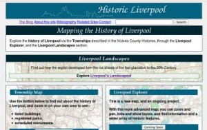
There are two new sections on Historic Liverpool: the Liverpool Explorer, and Liverpool Landscapes (I hope this is confusing enough!).

Liverpool Explorer is an ongoing project – a map which will display all the features that you can get information on throughout the Historic Liverpool website. It’s quite sparse at the moment, with layers for Listed Buildings, Parks and Gardens etc (the same layers visible through the Townships page), and in addition two dots on the new ‘Hidden Gems’ layer. The Hidden Gems are those things you can see in Liverpool today, which don’t (at least yet) readily fit into any other map layers. At present these only include the Church Street Cross and Williamson’s Tunnels. In time these may move to other layers, and other features will be added to Hidden Gems. Either way, this is a bit of a novelty layer, and I hope it provides some idle browsing if nothing else!

Keep an eye on Liverpool Explorer, which will collect all the features available through the rest of the site.

Liverpool Landscapes is an effort to get back to my site’s original aims: to map the archaeological landscape(s) of Liverpool and Merseyside. Have a look at What Is Landscape Archaeology? for an explanation. Each Landscape in this section will address a cross-section of Liverpool’s archaeology from a landscape perspective: how do all the sites in the theme interconnect? Initially this will include period-based landscapes (Natural, Prehistoric, Medieval, Civil War) but will grow to include a number of others. Perhaps some will seem arbitrary to you: where do religious or sporting landscapes begin and end? You may have ideas for some that you think are more important than the ones I’ve included. Please get in touch, or comment below! These are as yet unfinished; new things will be added to them and the pages will be updated over time.

Whatever your thoughts on the site, get them down in the comments section and I will do my best to respond.

Historic Liverpool on the Web

As things seem to be quiet on the ‘historic Liverpool’ front (that’s historic with a small ‘h’ – not my website!) I think it’s a good time to put down a few quick notes about where Historic Liverpool (the website!) and my interest in history on the web should be leading me in the next few weeks and months.

For those of you eager to see what additions will be made to the main site, I can tell you that I’m currently researching West Derby township. This includes the former villages of Tue Brook, West Derby, Knotty Ash and Broad Green, and will hopefully be online soon. Anyway, until then…

Every month new historical and archaeological resources go online (for example the Liverpool Wiki), and the ones that have been online for a while are constantly adding to their databases (see the Archaeology Data Service). Though the Council for British Archaeology’s website (recently relaunched) was a pioneer in making use of the web for archaeology, the historical and archaeological disciplines are only gradually making full use of the web, in particular “Web 2.0“, the interactive web. This new, user-generated form of the Internet is a big opportunity for history and archaeology, building on the participation seen in many amateur excavations in Britain for decades, and the discussion forums taking in Liverpool history amongst other city issues all over the Net.

It’s part of my job to know about what makes an attractive, usable, interesting heritage website, and I’d like to pass on what knowledge I can to help promote new archaeological and historical Web 2.0 sites. My own site, Historic Liverpool, shows my own modest efforts (more archaeology than Web 2.0!) but so much more sophisitcation is possible in this developing era that I really want to do what I can to help. With this in mind, I will shortly be launching a new website (to be named – watch this space!) dealing with [edit:] expanding this blog to include the wider developments in heritage on the web. There’ll also be a blog there, where I will put my thoughts down on the subject, along with longer articles on avoiding some of the pitfalls of building a complex or data-rich website aimed at the general public and interested amateur. After all, this is the advantage of the Internet, and the sharing of data and knowledge – anyone can become involved! Edit: for now I have little time to dedicate to a new website, so I’ll be mentioning interesting web initiatives on this blog until someone invents the 34 hour day and I have time to write two blogs!

Finally, while researching West Derby I read the relevant chapter in J.A. Picton’s Memorials of Liverpool, vol II, Topographical (1875). In it he details all the roads from Low Hill eastwards, and takes in Kensington, and Newsham Park. He rues the state of Wavertree Road:

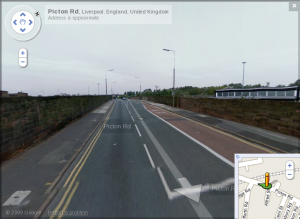
Picton Road as seen by the Google StreetView car

Picton Road as seen by the Google StreetView car

“at present a somewhat unsightly entrance into Liverpool … flanked with shops and dwellings of an inferior class. Down to 1830 this road was a beautiful avenue lined with tall trees on each side, whose umbrageous foliage meeting overhead, imparted a grand and solemn character to the vista. The construction of the railway crossing the road … and the subsequent construction of the bridge … made the first inroad”

This fairly judgementmental description of the area is typical of this wonderful book, but the modern mapreader must note that whereas in 1875 Wavertree Road stretched all the way to Wavertree (of course), these days the length from Picton’s bedevilled railway bridge to the clock tower is of course… Picton Road.

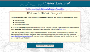
Historic Liverpool website complete

As you may or may not know, the Liverpool Landscapes blog is partner to the Historic Liverpool website. That website is now ‘complete‘.

The Historic Liverpool websiteOf course, no website worth its salt is ever really complete, but you should be able to browse and read everything, and find a lot of interesting bits of history in your part of the city – or any part of the city! The main feature is the interactive map. Here you can begin to zoom in and pan around (and zoom out again!) and click on any of the dots on the map which interest you. There are also a couple of other things you can find on there, such as a rough outline history of the city of Liverpool as it developed from a backwater fishing village in the shadow of West Derby and Chester to a major port and settlement in its own right.

Of course, now that everything is tidily complete, the next thing I’m going to do is add bits piecemeal all over the place, so keep popping back and you’ll find more there to look at.

The most important thing now, though, is to ask for your help. Do you know any ‘secret’ or hidden bits of history dotted around Liverpool, or Merseyside in general? That’s going to be the focus of additions to the site. If you send me your suggestions, complete with a little description and location, then I’ll put a pin in the map so everyone can see it! Full credit will be given to you, of course! If you’ve got a photo I can use, all the better! All comments are gratefully received, at martin [at] historic-liverpool.co.uk.

A new final draft website

This blog is the companion to www.historic-liverpool.co.uk, a website about the history, growth and expansion of the city of Liverpool, and the surrounding area. That website has been in production for about four years, on and off, with too many false starts and rewrites for a sane man to handle. But now the bare bones of the site are there: all the links should work, you can find out a hell of a lot about the city and its suburbs, and it shouldn’t look too shoddy either.

Please visit and take a look around, and if you like what you see, or have any suggestions for how I should be developing this website, then please send me an email. Of course, if you’d like to encourage my love of Liverpool history, take a look at my Amazon Wish List!

New address, same old stories

This is the new location of the blog formerly known as the Liverpool Times. The name coincided with another website and news source, and I fancied a change! The posts below are the same as those you would have found on the old blog, and the topics I cover will be the same, ie. the changing face of Liverpool and Merseyside. If you’ve been here before, I hope you continue to enjoy it; if not, then welcome!

Martin

A new look and a new name

We’re entering a new era for the website and blog (!) as the site formerly known as Liverpool Landscapes is now called Historic Liverpool, and resides at Historic-Liverpool.co.uk. A lot of work has gone into the site recently, although there’s still a hell of a lot to be done. However, now you can read plenty of information about each township, and how it has evolved over the centuries. This will be improved over the coming months, and there are a handful of pages labelled as ‘Under Construction’. Feel free to explore these, though, as there’s a brief explanation on each as to what you will soon be able to find. At the moment I’m working on the Before Liverpool page [Edit 24/01/09: this has now been replaced with the Prehistoric Merseyside page), which will show all about how the natural landscape was formed, how it affects the way the city of Liverpool looks today, and follows this with the human occupation of the region from the earliest prehistoric periods up to the time of King John, and what influenced him to found a new town.

My favourite new feature of the site is the map background, which has changed from a dull green and blue to a full-featured 1940s Edition Ordnance Survey map. This is made possible by the Web Mapping Service on GetMapping run by Nick Black, using tiles scanned by the New Popular Editions staff. This makes my site look a hell of a lot better, so thanks to them for producing this project.

So keep an eye  on Historic-Liverpool.co.uk for more updates soon!

Liverpool’s Trams Old and New

Everton FC’s controversial plans to move to a new stadium in Kirkby are strengthening the case for “line one”, the non-capitalised tram scheme from Liverpool city centre to the outskirts. This follows claims in mid-April that Transport Secretary Ruth Kelly was ready to approve the £328m transport link.

Of course, trams are nothing new in Liverpool, which can trace their history back to 1869, and the 16 horse-drawn trams which were brought into use then. The service stopped on August 14th, 1957, when Liverpool discarded the trams in favour of buses. The network left behind many remnants embedded in the towns fabric, from the central reservations of the suburbs to the cobbles under the tarmac of the city centre streets.

Another thing which stands in favour of recreating the tram system shapes the very city we see today. As I mentioned, many of the wide boulevards which snake through the suburbs, such as Edge Lane, Muirhead Avenue and Queen’s Drive. Hidden under the grass the tracks no doubt still lie there. Of course it wouldn’t make sense to try to re-use the rusty metal, but the long curves of the roads themselves lend well to the three or four carriages which modern tramways like those in Sheffield and Manchester. In fact, if you look at a map of Liverpool, you can see how the tramways of the last century, and the routes people took into work – the financiers, traders and sailors – had an influence on the growth and development – the very shape – of the city in its boom era.

Some news about the main website: I’m releasing all the information on the website under a Creative Commons License, specifically the Attribution Non-commercial Share Alike (by-nc-sa), which means you are allowed to create works based on my work, as long as it’s not for commercial reasons, and you are willing to share what you’ve created too. It’s all in the spirit of sharing! For more details on what the license means, read the easy and short version, or the longer, legalese-heavy code.

The joys of a landscape website

As there hasn’t been a lot of landscape-related news involving Liverpool lately, I thought I’d take this chance to discuss the joys and frustrations of creating the Liverpool Landscapes website. The site uses MapServer, a piece of software that draw the maps to show you where the listed buildings and scheduled monuments are, along with other points if interest. Using a series of layers, I can tell MapServer how to draw the maps, and the user – you – can have some control over how those layers are displayed. The points and shapes representing the monuments are free to use and easy to come by on one of English Heritage’s websites. The boundaries of the townships were traced from an old map I found Googling around the ‘Net at Christmas. However, I think the map has limited use until I find decent street-level map. In Britain, mapping is produced by the Ordnance Survey, and that organisation has very protective rules over the re-use of its data, despite opposition to this. Despite the fact that they seem to be creating some more permissive licensing, I’m still a bit wary over how I’m allowed to use any maps I can find, unless I shell out more money than my salary allows. I’m still researching the best way to get MapServer compatible maps of Liverpool to use as a backdrop, without breaking the bank. Considering I’m not making any profit from this site, I’d be fascinated to hear of any suitable ways of getting hold of this data. Meanwhile, the best option looks like New Popular Editions.

Anyway, apart from the problems of creating the maps, there are the small details that come out when looking at the landscape of Liverpool. Recently looking at the development of Everton, and the Welsh community that grew up in the area during the 19th Century, I came across a row of streets built near Goodison Park by the father and son team Owen and William Owen. Read the initials of the roads starting from Oxton Street, heading north.

More interesting snippets on the way!