I saw three (or more) ships…
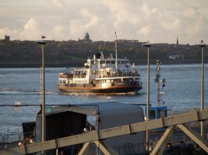
I’m currently doing a little bit of research for the River Mersey page on Historic Liverpool, and have come across a quite anoraky, but truly amazing site about shipping. It’s called ShipAIS, and is run by “A group of ShipPlotter enthusiasts”. The site, like my own I suppose, is based around a map tracking all the shipping (or as much as possible) in UK waters, from Orkney to the coast of mainland Europe. The site built up from one man experimenting with motion detecting photography from his own window, and now includes the AIS information (identification and callsign info broadcast over the radiowaves). The ships are plotted on the map, including a couple of tracks (I noticed a track for the Mersey ferry Royal Iris when I was on the site today).
My recommendation for readers of this blog would be to look at the map of Liverpool Bay, then click on one of the ships you see in the port for a detailed view of that area. In many cases you get a small photo of the ship in question, and in all cases you get the name of the ship, its speed, type, tonnage and a couple of other details.
The site could do with a few more controls to zoom and pan round the map, but this is a fascinating insight into Liverpool’s current role as a port, and the national context in which it sits. I could quite happily while a way an hour or so each day just exploring the map, and the site as a whole clearly has Merseyside origins and a Mersey focus. Go and have a look!


