As things seem to be quiet on the ‘historic Liverpool’ front (that’s historic with a small ‘h’ – not my website!) I think it’s a good time to put down a few quick notes about where Historic Liverpool (the website!) and my interest in history on the web should be leading me in the next few weeks and months.
For those of you eager to see what additions will be made to the main site, I can tell you that I’m currently researching West Derby township. This includes the former villages of Tue Brook, West Derby, Knotty Ash and Broad Green, and will hopefully be online soon. Anyway, until then…
Every month new historical and archaeological resources go online (for example the Liverpool Wiki), and the ones that have been online for a while are constantly adding to their databases (see the Archaeology Data Service). Though the Council for British Archaeology’s website (recently relaunched) was a pioneer in making use of the web for archaeology, the historical and archaeological disciplines are only gradually making full use of the web, in particular “Web 2.0“, the interactive web. This new, user-generated form of the Internet is a big opportunity for history and archaeology, building on the participation seen in many amateur excavations in Britain for decades, and the discussion forums taking in Liverpool history amongst other city issues all over the Net.
It’s part of my job to know about what makes an attractive, usable, interesting heritage website, and I’d like to pass on what knowledge I can to help promote new archaeological and historical Web 2.0 sites. My own site, Historic Liverpool, shows my own modest efforts (more archaeology than Web 2.0!) but so much more sophisitcation is possible in this developing era that I really want to do what I can to help. With this in mind, I will shortly be launching a new website (to be named – watch this space!) dealing with [edit:] expanding this blog to include the wider developments in heritage on the web. There’ll also be a blog there, where I will put my thoughts down on the subject, along with longer articles on avoiding some of the pitfalls of building a complex or data-rich website aimed at the general public and interested amateur. After all, this is the advantage of the Internet, and the sharing of data and knowledge – anyone can become involved! Edit: for now I have little time to dedicate to a new website, so I’ll be mentioning interesting web initiatives on this blog until someone invents the 34 hour day and I have time to write two blogs!
Finally, while researching West Derby I read the relevant chapter in J.A. Picton’s Memorials of Liverpool, vol II, Topographical (1875). In it he details all the roads from Low Hill eastwards, and takes in Kensington, and Newsham Park. He rues the state of Wavertree Road:

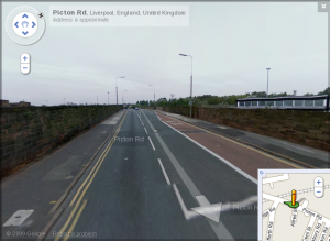
Picton Road as seen by the Google StreetView car
“at present a somewhat unsightly entrance into Liverpool … flanked with shops and dwellings of an inferior class. Down to 1830 this road was a beautiful avenue lined with tall trees on each side, whose umbrageous foliage meeting overhead, imparted a grand and solemn character to the vista. The construction of the railway crossing the road … and the subsequent construction of the bridge … made the first inroad”
This fairly judgementmental description of the area is typical of this wonderful book, but the modern mapreader must note that whereas in 1875 Wavertree Road stretched all the way to Wavertree (of course), these days the length from Picton’s bedevilled railway bridge to the clock tower is of course… Picton Road.


